Identity area
Reference code
AU WA S33- cons7109 1
Title
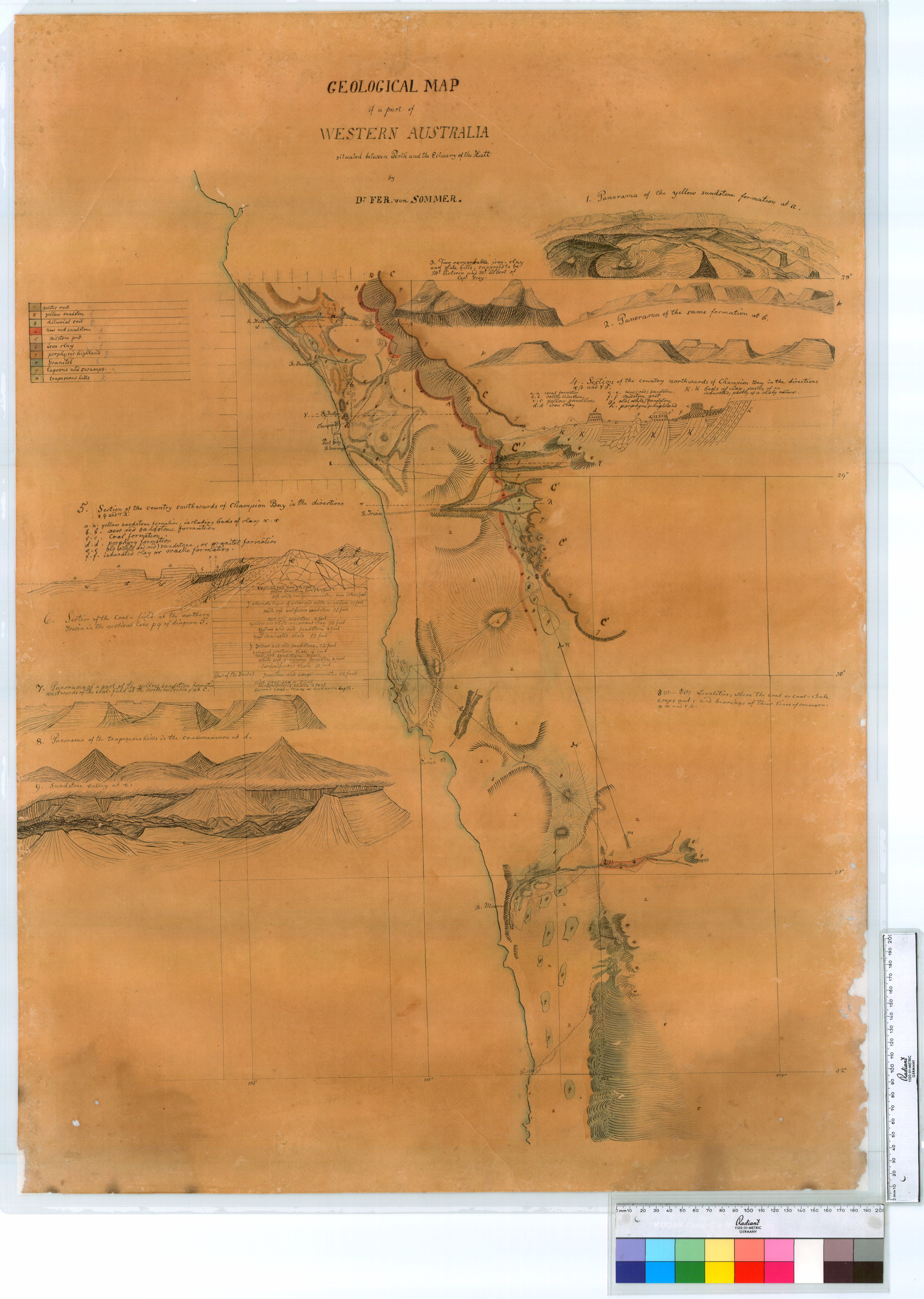
Geological map of a part of Western Australia situated between Perth and the estuary of the Hutt.
Date(s)
- 1848-01-01 - 1848-08-31 (Accumulation)
Level of description
Item
Medium
Status
Context area
Name of creator
AU WA A103 - COLONIAL SECRETARY'S OFFICE
(1828-12-30 - 1924-04-16)
Repository
Archival history
Content and structure area
Scope and content
Accruals
System of arrangement
Conditions of access and use area
Conditions governing access
Open
Conditions governing access (legacy)
Open access
Conditions governing reproduction
Language of material
Script of material
Language and script notes
Physical characteristics and technical requirements
Finding aids
Allied materials area
Existence and location of originals
Related units of description
Related units of description
Access points
Place access points
Description control area
Level of detail
Language(s)
Script(s)
Sources
Digital object metadata
Filename
Cons_7109_Item_01.jpg
Latitude
Longitude
Media type
Image
Mime-type
image/jpeg
Filesize
3.1 MiB
Uploaded
28 August 2015 12:08 PM