Showing 4 results
Archival description3 results with digital objects Show results with digital objects
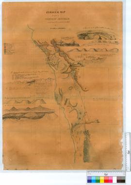
Geological map of a part of Western Australia situated between Perth and the estuary of the Hutt.
AU WA S33 cons7109 1
![Geological Map of parts of Western Australia situated eastwards and southwards of Perth, and between King Georges Sound and Cape Rich [Riche].](/uploads/r/srowa/5/1/51dbcebba2f4f737e4fa9d0117eb692bd8402ff7727a4e32243c23f82da9078f/Cons_7109_Item_02_142.jpg)
Geological Map of parts of Western Australia situated eastwards and southwards of Perth, and between King Georges Sound and Cape Rich [Riche].
AU WA S33 cons7109 2
![Geological map of parts of Western Australia situated between Perth and Cape Naturalist [Naturaliste] and between York and Doubtful Island Bay.](/uploads/r/srowa/5/3/537b7913a7503b7e72ae875bcfac47f7b3598da2a079c92fb7f61c9134be91c8/Cons_7109_Item_03_142.jpg)
Geological map of parts of Western Australia situated between Perth and Cape Naturalist [Naturaliste] and between York and Doubtful Island Bay.
AU WA S33 cons7109 3
MAPS - GEOLOGICAL SURVEY
MAPS - GEOLOGICAL SURVEY
AU WA S33