Identity area
Reference code
AU WA S235- cons3868 287
Title
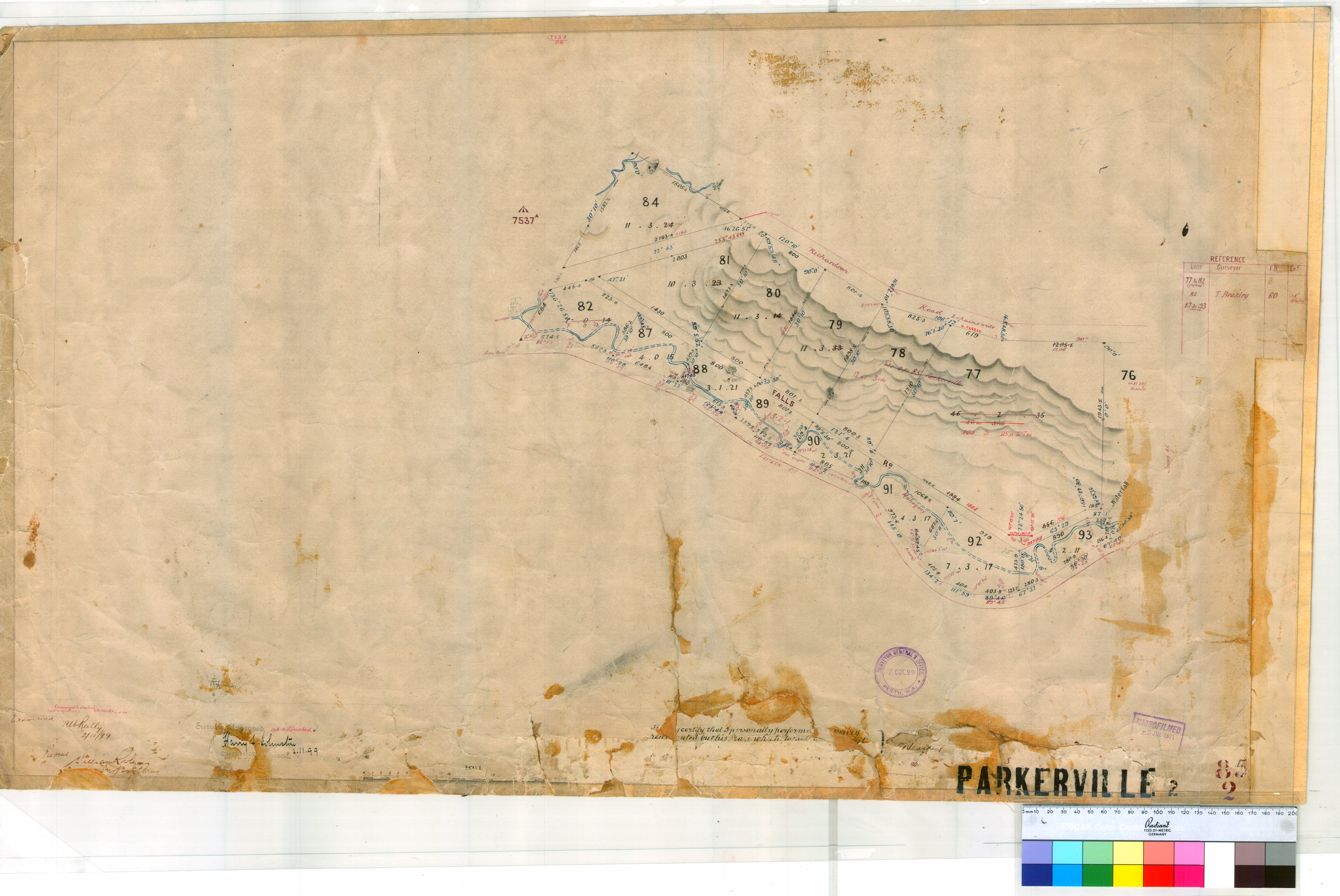
Parkerville 85/2. Plan of Parkerville Townsite showing Lots 77-82 inc., 84, 87-93 inc. by T. Beasley Fieldbook 60 dated 1899 (vicinity of Richardson & Falls Roads & Eastern Railway line) [scale: 40 chains to an inch].
Date(s)
- - (Accumulation)
Level of description
Item
Medium
Status
Context area
Name of creator
AU WA A42 - DEPARTMENT OF LANDS AND SURVEYS
(1890-01-01 - 1986-07-01)
Name of creator
AU WA A58 - SURVEY OFFICE
(1829-01-01 - 1870-01-01)
Name of creator
AU WA A59 - SURVEYOR-GENERAL'S DEPARTMENT
(1870-01-01 - 1873-01-01)
Name of creator
AU WA A60 - CROWN LANDS AND SURVEYS DEPARTMENT
(1873-01-01 - 1890-01-01)
Repository
Archival history
Content and structure area
Scope and content
Accruals
System of arrangement
Conditions of access and use area
Conditions governing access
Open
Conditions governing access (legacy)
O
Conditions governing reproduction
Language of material
Script of material
Language and script notes
Physical characteristics and technical requirements
Finding aids
Allied materials area
Existence and location of originals
Related units of description
Related units of description
Access points
Place access points
Description control area
Level of detail
Language(s)
Script(s)
Sources
Digital object metadata
Filename
cons_3868_item_287.jpg
Latitude
Longitude
Media type
Image
Mime-type
image/jpeg
Filesize
3.3 MiB
Uploaded
23 September 2015 10:39 AM